


RECREATION
Hiking
Kingdom Trails has over 100 miles of trails to explore. A Kingdom Trail map can be purchased at Kingdom Trails. If a more vigorous workout is more your style, then take a hike up Burke Mountain. The view from the top is well worth it! Kingdom Adventures Mountain Guides provides instruction in rock and ice climbing, mountaineering, first aid training, and more.
For information about Vermont State Parks and Trails, CLICK HERE.
NorthWoods Stewardship Center also has trails on site as well as maps of many local trails.
Willoughby State Forest Trails Guide
{ ATV Tours } { Biking } { Golfing } { Hiking } { Horseback Riding } { Ice Climbing } { Nordic Sports } { Skiing } { Snowmobiling } { Water Sports }
Haystack Mountain
At an elevation of 2712 feet, Haystack Mountain is located just outside of Willoughby State Forest in Westmore. The low, but rugged, peak is aptly named for its abrupt sides that climb steeply from all directions. The peak is accessible by two trails, the North Trail and South Trail, and offers excellent local views towards Long Pond, Bald Mountain and beyond in several directions.
Long Pond Road, Westmore, VT

Kingdom Corn Maze & Pumpkin Patch
Experience fall fun at our family farm! Navigate through our corn mazes, enjoy farm-themed attractions, and pet adorable animals in our barn. Indulge in sweet treats at our ice cream shop, visit the gift shop, and enjoy pumpkin and sunflower picking. Check out our special event weekends and thrilling flashlight night mazes!
1416 Burke Road, Sutton, VT 05867
802-424-7227
kingdomcornmaze@gmail.com | https://kingdomcornmaze.com
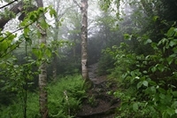
Mt. Pisgah Trails in Westmore
Westmore is located just 15 minutes from Burke and is home to several mountains and great hiking trails including Mt. Pisgah. Don't forget to bring a camera to capture the spectacular rewards of your journey upwards.
Route 5A, Westmore, VT
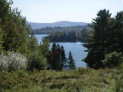
Mt. Hor
Elevation 2648 feet. The summit offers near views of several ponds in the valley to the west and a distant view of the Green Mountains. From the two Lake Willoughby overlooks you'll have views of the lake below and distant views of the White Mountains, Owl's Head and Mount Orford.
Westmore, VT
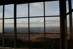
Bald Mountain Trails
Located in the Town of Westmore, Bald Mountain is the third highest peak in the Northeast Kingdom and provides one of the best views of the region from its recently restored fire tower.
Westmore, VT